
I also printed out our Bahamas customs form which I'll file for now with our Florida and Bahamas cruising guides. I'm starting to feel like this trip is next week, but we are still 4 months away.

I finally reached Steve Marsh at The Finish Line and confirmed that we can leave our car and trailer at his place in Stuart, Florida. Steve had some great recommendations for getting to West End and back. I was thinking about leaving my car/trailer farther south than Stuart, but Steve convinced me that Stuart was a smart place to return to from West End, Grand Bahama because the Gulf Stream will push us to the North on our return. But what about getting to West End on the way over? Steve suggested either motoring up the ICW or sailing 30 miles down the coast to The Port of Palm Beach. I could then rest up an refuel if needed in The Port of Palm Beach before taking off for West End, Grand Bahama. So, unless anything else changes, that's the plan for now. Here are what the new charts look like:
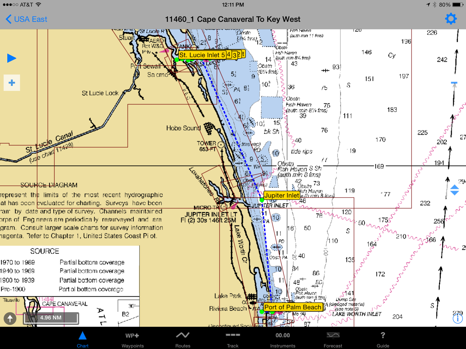
The first leg would be 28+ nautical miles from Sandsprit Park in Suart, FL to Peanut Island near The Port of Palm Beach, FL. I'd like to get in the water on the morning of Friday, June 12th and get down to The Port of Palm Beach that afternoon. Then, we could rest up a bit before heading for West End, Grand Bahama early on the morning of the 13th. We would then clear in and rest up before heading across the Little Bahama Bank on Sunday the 14th. We would go as far as we could go on the 14th - maybe stopping at the Great Sail anchorage for the evening. On Monday the 15th, we would again go as far as we could go before calling it a day hopefully somewhere in the Sea of Abaco - Spanish Cay, Nunjack Cay, etc? Finally on Tuesday the 16th, I would hope we would be at our dock in Eastern Shores outside of Marsh Harbor.
The main considerations in leaving from The Port of Palm Beach instead of Stuart are crossing distance and the Gulf Stream. If we leave from Stuart, the first leg would be approximately 67nm including almost 30nm of southing against the Gulf Stream. Alternatively, if we head down the coast from Stuart to Palm Beach first, we get in almost all of the the southing we need, and the crossing distance goes from approximately 67nm to 55nm with only 4nm of southing needed. So, this is the crossing plan for now.
By the way, if you are interested in learning more about the Gulf Stream, I picked up a great book a couple of years ago called simply "The Gulf Stream" by Stan Ulanski. I found it to be a fascinating history and scientific analysis of one of the world's greatest ocean currents.

No comments:
Post a Comment